Quarrying and the environment
Introduction | Landscape | Planning controls | Water and caves | Dust, noise and traffic | Blasting | Nature conservation
Landscape
Concerns about the impact of quarrying on the landscape have been raised since the early 1900s. Initially, quarries were often seen as a part of the rural scene — in 1898, the trade journal, 'The Quarry', commented that the Mendip Hills comprised 'some singularly picturesque scenery' and that Vallis Vale 'was a romantic vale' but that 'unlike many works, they [the quarries] did not detract from the beauty around, but afford a pleasant break in the steep wooded slopes'. However only nine years later, views had changed: the same journal remarked that 'Vallis Vale in which they are situated is one of the prettiest of its kind in the country' and some concern was then expressed at the prospect of disfiguring 'so picturesque a spot' by industrial operations.
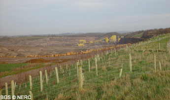
Further west, a more vociferous campaign was waged against quarrying in Cheddar Gorge. Quarrying had taken place for some years here when, in the early 1900s, the recently formed National Trust began serious lobbying of local authorities to press for a cessation of quarrying activities. Writing to Somerset County Council in 1904 the Trust asserted that
'for some years past the beauty of the cliffs had been marred by quarrying and it was possible that the extent of the injury which would ensue if the present operations were allowed to continue'...'the spot where the work is carried out is at the finest part of the pass where the cliffs are, or were until the recent quarrying, precipitous on each side'.The political pressure paid off and by 1912 the quarry had been closed down.
In the 1950s, the County Development Plan for Somerset defined areas of 'Great Landscape Value' stretching from Weston-super-Mare along the Mendip Hills as far as the Wiltshire border. This designation sought to protect landscape from adverse development, but accepted that it contained significant areas of existing and potential mineral working as authorised previously.
Meanwhile, the Mendip Hills Area of Outstanding Natural Beauty (AONB) covering 198 sq km stretching from Brean Down eastward to the A39 between Wells and Chewton Mendip came into force in 1972. The designation included quarries at Sandford, Cheddar, Shipham and a few between Shepton Mallet, Wells and Oakhill. There is an on-going debate as to whether the AONB should be extended to cover eastern Mendip. Certainly from a geological perspective, the current eastern boundary is not logical.
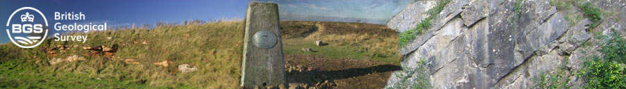
The careful planning of quarries and the favourable topography of eastern Mendip have enabled two of the largest quarries in Europe to develop almost unseen from ground level. Engineered screen banks planted with native tree species and workings 'dropped' into plateau areas, rather than cutting into valley sides, together with processing plant located on the quarry floor itself, have minimised visual intrusion. In fact, many modern quarry workings are far less apparent to the casual visitor than that of the average farm, the other main primary industry of the area.
Unfortunately this favourable set of circumstances does not always exist. For example, in the case of the Silurian volcanic rocks, the outcrop of the best quality road surfacing material is extremely narrow and has to be worked at great depth. This coupled with the significant volumes of unusable material which have to be dug in order to win good stone, results in the need to build up large spoil heaps. This also restricts the location of the processing plant to areas away from the main quarry. However, even at Moon's Hill, new plant is being relocated and the use of material is being optimised to reduce waste; the latter will be used for screen mounding. In western Mendip, workings tend to cut more into the main scarp as at Callow Rock and especially Batts Coombe and therefore cannot be readily hidden. The latter can be seen by travellers on the M5 some miles away. In order to reduce the long-term visual impact, final rock faces will be treated in such a way that over time with weathering and judicious planting, they will appear similar to natural rock faces.
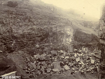
Many of the abandoned quarries, even those worked into the 1970s and 1980s on a relatively large scale for example Asham Quarry, have now begun to blend into the landscape visually. Unlike some of the more rugged areas of the Pennines and Wales, conditions for rapid tree growth are relatively good, particularly in eastern Mendip.
- Home
- Overview maps
- Locality
areas
- Cheddar Gorge
- Charterhouse
- Blackdown
- Burrington Combe
- Shipham & Rowberrow
- Crook Peak & Axbridge
- Banwell to Churchill
- Priddy
- Harptree & Smitham Hill
- Draycott & Westbury-sub-Mendip
- Wookey Hole & Ebbor Gorge
- Wells
- Great Elm & Vallis Vale
- Mells & the Wadbury Valley
- The Vobster area
- The Whatley area
- Torr Works & Asham Wood
- Beacon Hill
- Stoke St Michael & Oakhill
- Holwell & Nunney
- Shepton Mallet & Maesbury
- Gurney Slade & Emborough
- The Nettlebridge valley
- Geology
- Minerals and mines
- Quarrying
- Caves and karst
- Biodiversity
- Detailed site information
- Acknowledgements
- External links
- Search
- Site map