Priddy
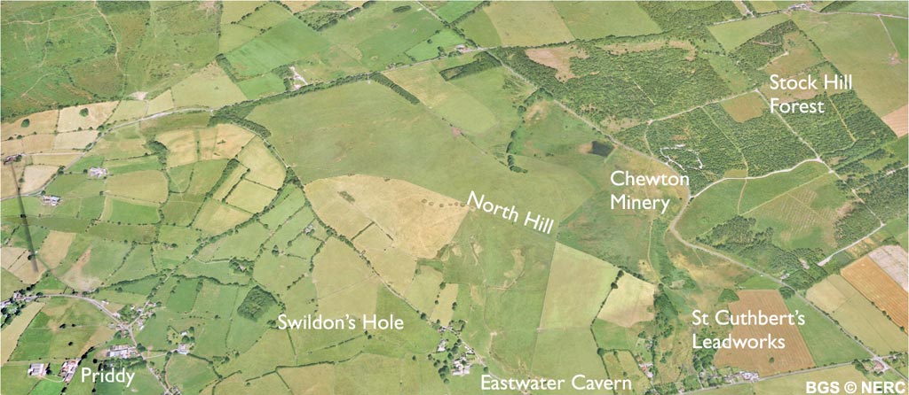
Priddy is located in the heart of the Mendip Plateau, on the western side of the North Hill pericline. North-west of the village is North Hill. At 305 m, it is one of the highest points on Mendip and is formed from the more resistant sandstone of the Portishead Formation.
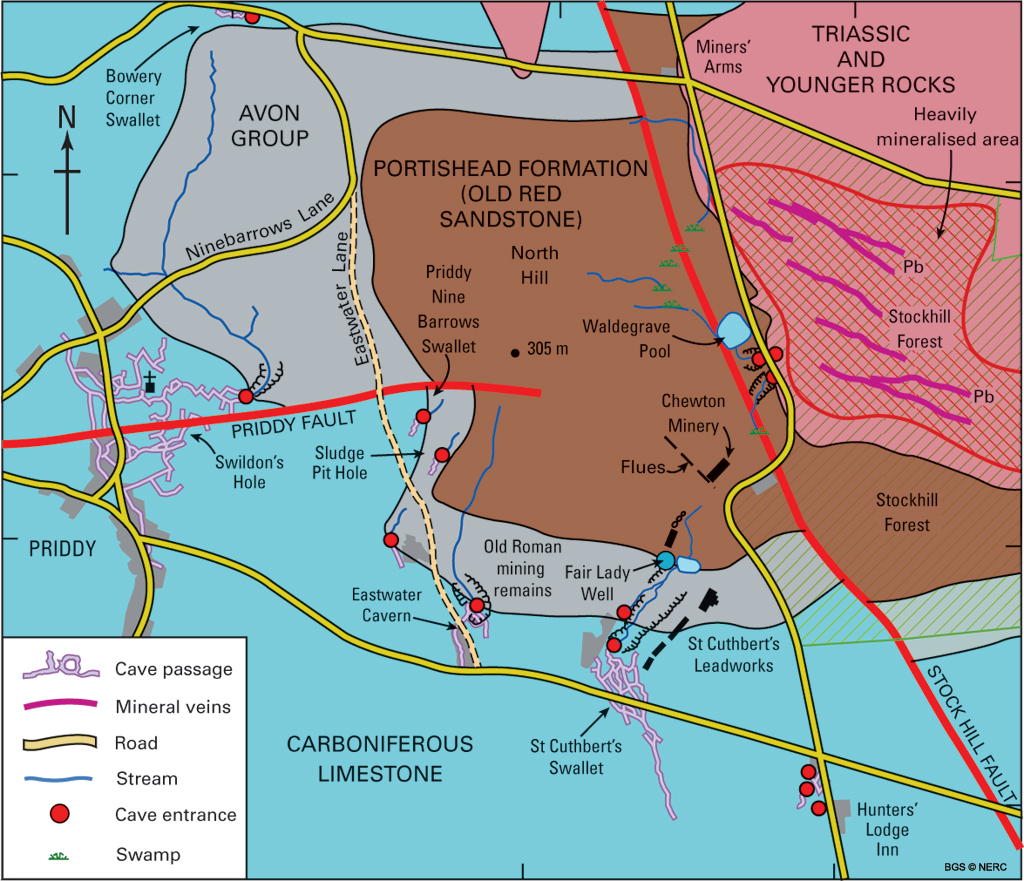
The younger Avon Group mudstone forms a belt of damp marshy ground around the hill, often marked by a shallow valley.
Much of Priddy village is on the Black Rock Limestone, which dips gently to the south at about 25°. Although there are very few exposures, the rocks can be seen in many of the dry stone walls. To the east of North Hill is an area of a Dolomitic Conglomerate and Mercia Mudstone which infills a deep Triassic wadi. Good examples of the red breccia and conglomerates can be seen in the dry-stone walls around Stockhill Forest.
Caves
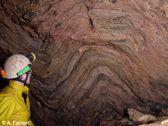
Several major cave systems occur around North Hill, formed where water draining off the sandstone sinks underground on reaching the surrounding limestone. Swildon's Hole is the longest cave on Mendip, with over 9 km of passage. First descended in 1901, it is also one of the earliest systematically explored caves in Britain. Cavers can follow the stream through several water-filled sections to a point 170 m directly below the Queen Victoria Inn on Priddy Green. Two other smaller swallet caves occur nearby. Eastwater Swallet is located at the end of a classic small blind valley, while St Cuthbert's Swallet is the second longest cave on Mendip at nearly 7 km, and certainly the most complex. The water from all three caves reappears at Wookey Hole. Several other smaller caves exist in the area, particularly around the Hunter's Lodge Inn.
Many large sinkholes occur in Stockhill Forest where the ground has subsided into dissolution cavities in the limestone-rich conglomerate.
Lead mining
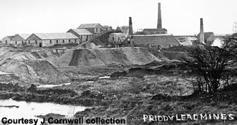
The Priddy area was an important lead mining area from Roman times right up to the beginning of the 20th century. The ore, principally galena, was won from veins in the Triassic Dolomitic Conglomerate in what is now Stockhill Forest. Numerous closed depressions pock-mark the area and the remains of the lead workings with spoil heaps, pits, leats and reservoirs are still clearly visible in the valley between North Hill and Stockhill Forest. The area lay between two mining ownerships known as 'liberties'.
The St Cuthbert's Leadworks operated by the Bishop of Bath and Wells lies at the southern end of the valley. Farther north the Chewton Mineries, owned by the Waldegrave Family was located near Waldegrave Pool.
In 1860, the owners of Wookey Hole Paper Mill, concerned about pollution of their water supply, traced the water from St Cuthbert's Swallet to Wookey Hole using 'Vanadium Red' dye, having first had several unsuccessful attempts using chaff and even ink. This provided the basis for a successful lawsuit in 1863 against the St Cuthbert's Leadworks for polluting the stream. This has since been confirmed by more recent dye tracing, the water flowing to Wookey Hole in about eight hours.
Flora and fauna
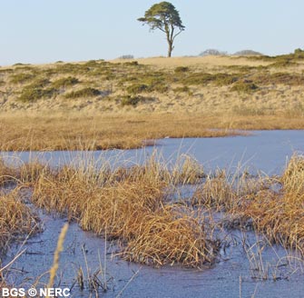
The St Cuthbert's and Chewton Mineries are now a Nature Reserve, known as 'Priddy Mineries', managed by the Somerset Wildlife Trust. The site has a variety of distinctive habitats including valley mire, open water and wetland habitats, and lead-rich spoil heaps, and the site supports a very wide range of flora and fauna. In particular, valley mire is a very uncommon habitat in the Mendip Hills and here it is especially important for its rich wetland flora, supporting good populations of all three British newts, many different species of dragonfly, as well as frogs and toads.
The spoil heaps are high in lead and other heavy metals, and this generally deters vegetation growth. The rare alpine penny-cress and spring sandwort thrive on lead-rich soil, and the loose black slag is stabilised by rafts of mosses and lichens, including very rare moss Ditrichum plumbicola.
- Home
- Overview maps
- Locality
areas
- Cheddar Gorge
- Charterhouse
- Blackdown
- Burrington Combe
- Shipham & Rowberrow
- Crook Peak & Axbridge
- Banwell to Churchill
- Priddy
- Harptree & Smitham Hill
- Draycott & Westbury-sub-Mendip
- Wookey Hole & Ebbor Gorge
- Wells
- Great Elm & Vallis Vale
- Mells & the Wadbury Valley
- The Vobster area
- The Whatley area
- Torr Works & Asham Wood
- Beacon Hill
- Stoke St Michael & Oakhill
- Holwell & Nunney
- Shepton Mallet & Maesbury
- Gurney Slade & Emborough
- The Nettlebridge valley
- Geology
- Minerals and mines
- Quarrying
- Caves and karst
- Biodiversity
- Detailed site information
- Acknowledgements
- External links
- Search
- Site map