
Harptree and Smitham Hill
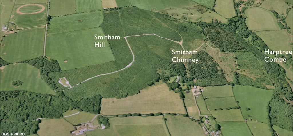
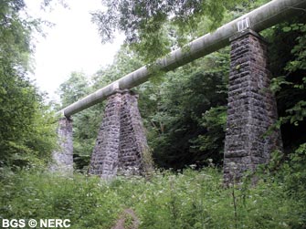
East and West Harptree are located at the mouth of Harptree Combe, a narrow gorge cut into the Dolomitic Conglomerate down which a small stream flows. The gorge is a SSSI for its flora and fauna, and contains several distinct wildlife habitats including old ash woodland, rough grassland, marshy grassland and rocky crags. Half way down the combe, an aqueduct crosses the valley. This is part of network of aqueducts and tunnels feeding spring water from Chewton Mendip to the Barrow Gurney reservoirs. The top end of Harptree Combe leads up onto Smitham Hill and East Harptree Woods, an area of woodland and heath developed on the Harptree Formation.
This rock is relatively impermeable and gives rise to a very boggy acidic soil with a characteristic heathland flora.
Lead mining
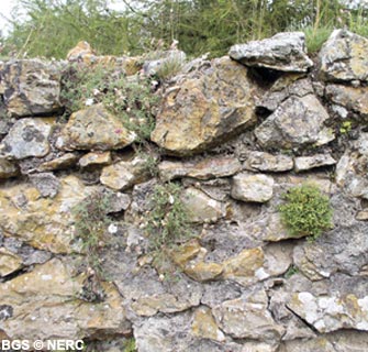
The Harptree area was an important lead and zinc mining area. Lead ore was mined from veins in the Carboniferous Limestone around Gibbets Brow and Lamb Leer, and manganese and zinc from veins in the Dolomitic Conglomerate around Harptree Combe.
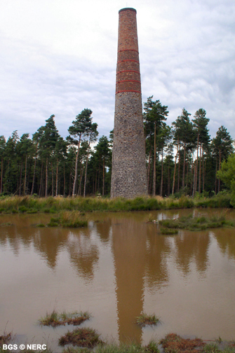
This has left a legacy of old pits, spoil heaps and shafts creating areas of pockmarked 'gruffy ground'. The lead-rich spoil heaps are home to several rare plant species. Much of the ore was processed and smelted on Smitham Hill where ore dressing and smelting works were built by the East Harptree Lead Works Company in 1867. The Smitham Chimney dates from this time and is the last old lead-smelting chimney still standing on Mendip.
Caves and karst
There are relatively few known caves in the Harptree area, but the largest, Lamb Leer Cavern was discovered in about 1674 by lead miners. The cave is 67 m deep and contains one of the largest chambers on Mendip. The area is also pockmarked with large sinkholes, particularly around the margins of the Harptree Formation. The largest is the Devil's Punch-Bowl, an impressive depression over 50 m in diameter and almost 20 m deep. These have been formed by the dissolution of Carboniferous Limestone and Dolomitic Conglomerate at depth, followed by collapse and subsidence of the cover rocks.
- Home
- Overview maps
- Locality
areas
- Cheddar Gorge
- Charterhouse
- Blackdown
- Burrington Combe
- Shipham & Rowberrow
- Crook Peak & Axbridge
- Banwell to Churchill
- Priddy
- Harptree & Smitham Hill
- Draycott & Westbury-sub-Mendip
- Wookey Hole & Ebbor Gorge
- Wells
- Great Elm & Vallis Vale
- Mells & the Wadbury Valley
- The Vobster area
- The Whatley area
- Torr Works & Asham Wood
- Beacon Hill
- Stoke St Michael & Oakhill
- Holwell & Nunney
- Shepton Mallet & Maesbury
- Gurney Slade & Emborough
- The Nettlebridge valley
- Geology
- Minerals and mines
- Quarrying
- Caves and karst
- Biodiversity
- Detailed site information
- Acknowledgements
- External links
- Search
- Site map