Quarrying and the environment
Introduction | Landscape | Planning controls | Water and caves | Dust, noise and traffic | Blasting | Nature conservation
Water and caves


A particular environmental issue on Mendip has been disruption of the underground water flow and the destruction of cave systems.
The Carboniferous Limestone is an important public water resource for much of the surrounding region, including around 500 000 people in the Bristol area. As water consumption has increased rapidly over the last 50 years, so the importance of the Mendip Hills as a source of groundwater has grown.
A major planning study carried out by Somerset County Council in the late 1960s (reported in 1971) highlighted the areas where, in the Water Authorities' view, quarrying would be detrimental to the water supply. In the main Mendip ridge, the only areas falling outside those zones were between Moon's Hill and Whatley Quarries, that between Nunney and Waterlip, a small area around Dulcote, and between Axbridge and Crook Peak. West Mendip is presently covered by Groundwater Protection Areas defined by the Environment Agency.
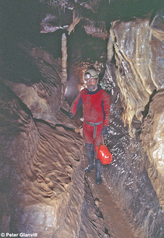
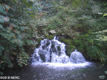
Groundwater flow in the Carboniferous Limestone is mostly through a network of underground conduits or caves. When quarries intercept these flow systems, firstly water can flood workings and alternatively be diverted by pumping, and in the process cut off the original flow, causing springs to diminish or dry up. As the springs themselves are often used for public water supply, this too can be interrupted. Thirdly, quarrying can cause fissures to become blocked e.g. by blasting vibration dislodging the rocks beyond the quarry void itself or by generating fine material which can be washed into fissures. In addition, the limestone has a significant water storage capacity, both above and below the water table. By removing the rock, quarrying can reduce the storage available in the aquifer.
Claims have been made at various times that Mendip quarrying has affected the flow in the famous thermal springs in Bath, but the evidence appears to be inconclusive.
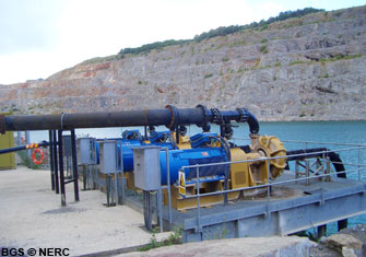
Stringent limits are placed on activities which could interfere with or contaminate water, for example workings are often not permitted to intercept the water table and if they are, strict regimes of pumping and water disposal are imposed.
Quarries also destroy any caves that they intersect. A classic example of a quarry intersecting a cave system draining to a spring is Fairy Cave Quarry, near Stoke St Michael. Here quarrying intersected 4.5 km of cave passage feeding St Dunstan's Well. By concentrating quarrying in the less karstic areas of eastern Mendip, the quarry companies can avoid intersecting major cave systems.
Furthermore, the larger quarry operators have made efforts to reduce the impact of sub-water-table working. The operators of Whatley quarry pump any water flowing into the quarry into the Mells River just upstream of the Mells River Sink, where water sinks underground, thus recharging the aquifer. Around Torr Works quarry a comprehensive groundwater monitoring and tracer testing scheme has been in operation since the mid 1980s.
- Home
- Overview maps
- Locality
areas
- Cheddar Gorge
- Charterhouse
- Blackdown
- Burrington Combe
- Shipham & Rowberrow
- Crook Peak & Axbridge
- Banwell to Churchill
- Priddy
- Harptree & Smitham Hill
- Draycott & Westbury-sub-Mendip
- Wookey Hole & Ebbor Gorge
- Wells
- Great Elm & Vallis Vale
- Mells & the Wadbury Valley
- The Vobster area
- The Whatley area
- Torr Works & Asham Wood
- Beacon Hill
- Stoke St Michael & Oakhill
- Holwell & Nunney
- Shepton Mallet & Maesbury
- Gurney Slade & Emborough
- The Nettlebridge valley
- Geology
- Minerals and mines
- Quarrying
- Caves and karst
- Biodiversity
- Detailed site information
- Acknowledgements
- External links
- Search
- Site map