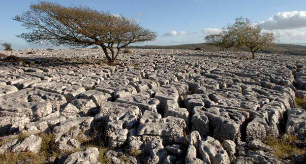
The Carboniferous Limestone
The Carboniferous Limestone as an aquifer
The Carboniferous Limestone is a massive, well-fissured karstic limestone that gives large water supplies of up to 175 l/sec from resurgences in the Mendips and South Wales, and borehole yields of up to 40 l/sec from the upper parts of the aquifer.
BGS have published a series of reports describing the baseline hydrogeochemistry of the major aquifers of the UK and a baseline report on the Carboniferous Limestone of northern England is available.
See also the Carboniferous Limestone in the BGS lexicon of named rock units.
Area where the Carboniferous Limestone is present
The Carboniferous Limestone aquifer is present in a number of areas in England and Wales, sometimes at great depth. It is found across large parts of northern England, eastwards from the Peak District to the Lincolnshire coast, in north east Wales, extensively in south Wales and across the Bristol Channel into the Mendips, Bristol and Bath area and at depth through parts of southern England including east Kent.
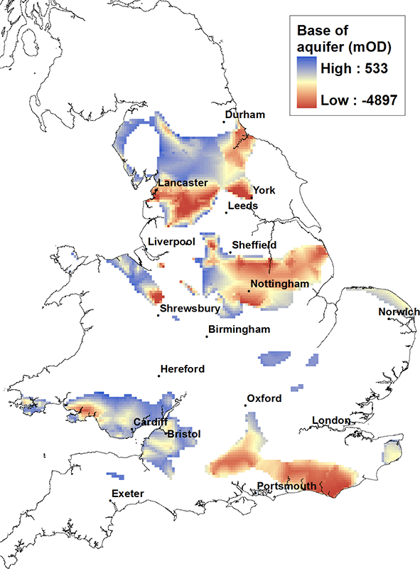
Elevation of base of the Carboniferous Limestone
At outcrop the base of the Carboniferous Limestone can be found at between 330 to 500 metres above OD, for example in the Peak District and in south Wales. However, in the centre of the northern England, north Wales and east Midlands basins, the Carboniferous Limestone aquifer formation can be found at depths well in excess of 3000 m below OD.
Contact
Please contact BGS Enquiries for more information.


