Groundwater in the floodplain
Groundwater in the Quaternary aquifers below the Eddleston Water floodplain is connected to water in the soil; to the river; and to groundwater in the underlying bedrock aquifer.
A large part of this work is investigating how groundwater in the floodplain interacts with water in the soil.
Sometimes it is hard to distinguish what is groundwater and what is soil water, because they are so closely linked — see Soil and shallow groundwater
Borehole drilling into the floodplain

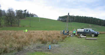
Nine boreholes were drilled into the Quaternary floodplain deposits at the Eddleston site, using a shell and auger (also called a percussion) drilling rig.
Geological samples were collected during drilling and detailed geological logs produced, to show how the Quaternary deposits change with depth and laterally across the floodplain.
These data were invaluable for creating the 3D geological model.
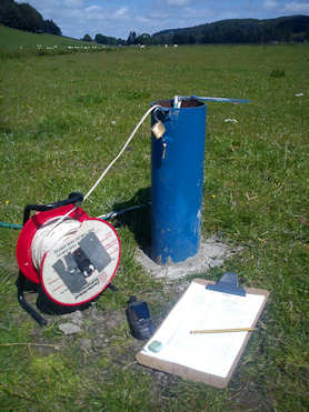
The boreholes were installed with piezometers for aquifer hydraulic testing and ongoing groundwater monitoring.
They were drilled in pairs, with one shallower (typically 4 to 5 m deep) and one deeper (typically 7 to 8 m deep) at each location.
Most of the boreholes have only one piezometer, but two boreholes have a pair of nested piezometers at different depths, and one has a triplet of piezometers.
Hydraulic testing

Six smaller, shallower piezometers were installed by hand using a Dutch auger in a wetland area in one part of the site, as three pairs between ground level and 2 m depth.
These are being used to characterise the hydraulic properties of the soil and shallowest underlying Quaternary deposits, which help to control the hydrology of the wetland, and to monitor wetland hydrology over time.
Test pumping of the floodplain and the wetland piezometers was done to establish the hydraulic properties of the geological deposits.
Three different pumps were used for testing, as the deposits have very different permeabilities. The highest yielding floodplain piezometers, which were constructed in highly permeable sands and gravels, were tested with a suction pump with a capacity of approximately 2 litres/second (l/s).
Lower yielding floodplain piezometers constructed in moderately permeable sands and silts, were tested with an electric pump with a capacity of approximately 0.14 l/s.
All of these were constant rate tests, where the piezometer is pumped at a constant rate for between 100 and 360 minutes. The water level in the borehole is monitored during pumping and after the pump is switched off, until it recovers to its natural level.
The alluvial and glaciofluvial deposits show generally moderate permeability, with most measured transmissivity values from test pumping between 200 and 400 m2/day.
Contact
Contact Brighid Ó Dochartaigh for further information


