Kimmeridge and Ampthill Clay
Geology of the Kimmeridge and Ampthill Clay
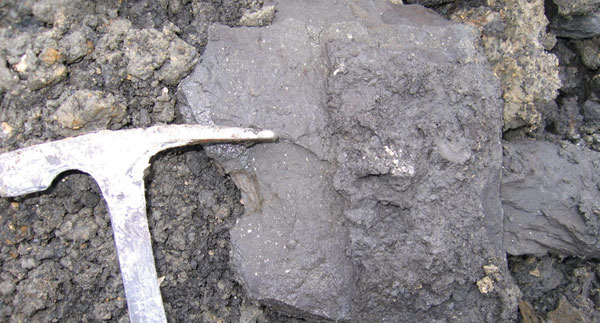
The Kimmeridge Clay consists of black shales with cementstones and oil shales. The DECC (2012) 3.5 MB pdf report states that the Kimmeridge Clay is "potentially prospective shale (for oil and probably biogenic gas) because it contains ubiquitous oil shale beds. Its background shale has total organic carbon (TOC) up to about 10%, its bituminous shale has TOC values up to 30% and its oil-shales have TOCs reaching 70% (e.g. the Blackstone Bed)".
See also the Kimmeridge Clay and the Ampthill Clay in the BGS lexicon of named rock units.
Area where the Kimmeridge and Ampthill Clay are present
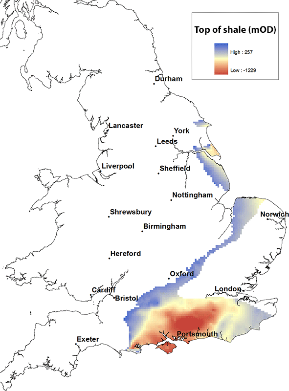
The Kimmeridge Clay is found from the Yorkshire coast in a swathe down the east coast of England to north Norfolk and then running south westward to the east Dorset coast and more extensively eastward through the Wessex Basin and throughout southern England.
Elevation of the top of the Kimmeridge and Ampthill Clay
The maximum height of the top of the Kimmeridge Clay is about 250 m above OD where it outcrops at the western end of the Wessex Basin and is at its deepest, within the centre of the Wessex Basin, it reaches depths of in excess of 1000 m below OD.
Contact
Please contact BGS Enquiries for more information.


