Bowland and Craven Groups
Geology of the Bowland and Craven Groups
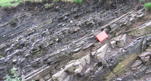
The Bowland and Craven Groups are variable fissile organic-rich mudstones, with thin limestones and local sandstone, siltstones, cherts and reef limestones.
Andrews (2013) states that "The organic content of the Bowland-Hodder shales is typically in the range 1–3%, but can reach 8% ... [and] is a function of burial depth, heat flow and time, but subsequent uplift complicates this analysis. Where they have been buried to sufficient depth for the organic material to generate gas, ... [they] have the potential to form a shale gas resource analogous to the producing shale gas provinces of North America. Where the shales have been less-deeply buried, there is potential for a shale oil resource... [and the] shales are considered mature for gas generation at depths greater than c. 2900 m [below ground level]. However, central Britain has experienced a complex tectonic history and the rocks here have been uplifted and partially eroded at least once since Carboniferous times. Because of this, the present-day depth to the top of the gas window is dependent on the amount of uplift, and can occur significantly shallower than 2900 m".
See also the Bowland Shale Formation and the Craven Group in the BGS lexicon of named rock units.
Area where the Bowland and Craven Groups are present
The Bowland and Craven Groups are present throughout northern England from the Yorkshire and Humberside coasts to Merseyside north to the Lancashire coast.
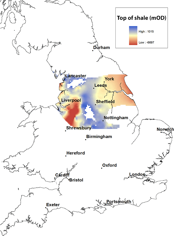
Elevation of the top of the Bowland and Craven Groups
The maximum height of the top of the Bowland and Craven Groups is about 1000 m above OD at outcrop and is at its deepest in the centre of the Cheshire Basin, reaching depths of over 6000 m below OD.
Contact
Please contact BGS Enquiries for more information.


