Susceptibility to groundwater flooding methodology

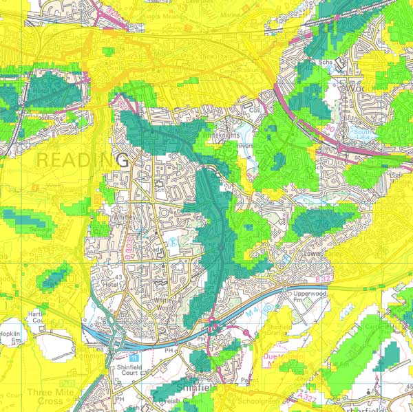
The BGS susceptibility to groundwater flooding dataset has been developed using a GIS rule-based methodology based on permeable superficial deposit (PSD) flooding and clearwater flooding conceptual models.
Initially, areas where low permeability formations are present at the ground surface were masked out as these are defined within the methodology as not prone to groundwater flooding.
Areas of groundwater flooding
The PSD and clearwater flooding scenarios define areas that have the potential for flooding — that are susceptible — on the basis of the presence or absence of permeable or impermeable bedrock or superficial deposits.
The BGS Permeability Index Dataset was used to identify these groundwater flooding areas.
The PSD flooding areas include all superficial deposits with maximum permeability indicies of very high and high with underlying bedrock with minimum permeability indicies of low and very low.
The clearwater flooding areas include all bedrock aquifers with maximum permeability values of very high and high except those overlain by superficial deposits with maximum permeability values of low and very low.
Once the PSD and clearwater flooding areas were prepared, conceptual model-specific rules were used to calculate relative depth to groundwater levels under groundwater flooding conditions.
PSD groundwater flooding derivation
There are four steps to the PSD flooding rule-based model:
- A river network was derived. This was necessary due to copyright issues with river network shapefiles and was achieved from a digital terrain model using the ArcGIS flow accumulation tools.
- As the conceptual model for PSD flooding assumes that groundwater in the permeable deposits are in hydraulic connection with water in rivers, the basic PSD flooding areas exclude polygons that are entirely outside a buffer of 500 m from the river network.
- In the absence of sufficient field observations, groundwater levels were modelled by assuming good hydraulic connection between surface water and groundwater and by interpolating the heighted rivers and coastline to create a continuous surface (River Base Level); the terrain model was then used to calculate depth to groundwater.
- Based on this depth to groundwater, PSD areas were divided into zones associated with the three susceptibility classes.
Clearwater groundwater flooding derivation
The approach for clearwater flooding is more complex. There are three steps to this rule-based model:
- Calculation of a representative 'minimum' groundwater level surface. This used a combination of three sources of groundwater levels: digitised contours from the BGS hydrogeological maps; point groundwater level data from the BGS Wellmaster database; and adjusted RBL to account for mounding beneath interfluves;
- Modification of the representative 'minimum' groundwater level surface to a representative 'maximum' groundwater level surface and calculation of depth to groundwater. This was done using information on groundwater fluctuations where available and, where not, a simple method was established for raising groundwater levels based on distance from the nearest river;
- Based on this depth to groundwater, PSD areas were divided into zones associated with the three susceptibility classes.
Combined dataset and validation of methodology
Once the susceptibility zones had been developed for PSD and clearwater flooding, the two were combined to produce a joint dataset. The national coverage also includes the zone for low permeability areas not considered to be prone to groundwater flooding.
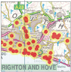
The BGS has data on the locations of previous groundwater flooding events gathered through research projects and discussions with environment regulators and local authorities. This information has provided a means to validate the susceptibility dataset.
Methodology for Scotland
The methodology for Scotland is slightly different to that described above for England and Wales.
In Scotland the PSD flooding areas have been expanded to include settings where PSD with permeability indicies of very high and high overlies bedrock with moderate permeability. This provides a better fit between the susceptibility to groundwater flooding and the observations of groundwater flooding in Scotland.
Contact
Contact Enquiries for further information


