Properties of the Chalk aquifer in the Thames Basin

The Chalk Group forms the most important aquifer unit within the Thames Basin, supplying water for drinking water public consumption and supporting river flows within chalk bournes characteristic of the Berkshire and Marlborough Downs, the Chilterns and North Downs.
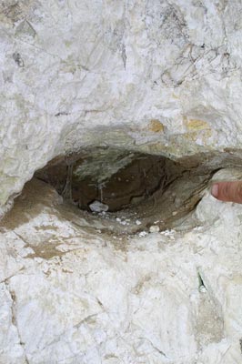
The Chalk is best described as a dual porosity medium with groundwater flow occurring within both the matrix and through fractures. Most of the aquifer's storage is derived from secondary porosity within these fractures.
The mixing of fracture groundwater with pore water in the aquifer matrix exerts an important control on Chalk hydrochemistry and the fate of pollutants such as nitrate.
Most fractures within the Chalk occur parallel to the bedding plane within the top 60 metres with a corresponding decrease in permeability with depth. A strong topographical control on transmissivity is also evident with high transmissivity values occurring within valleys decreasing towards the interfluves.
The Chalk at outcrop
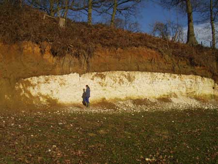
Where unconfined the Chalk is drained by intermittent streams within incised periglacial valleys.
Groundwater baseflow contributions are high (mean Baseflow Index or BFI 0.95) and spring lines are well developed at the intersection of hardgrounds such as the Tottenhoe Stone and at the base of the Chalk sequence.
The high fracture permeability and low effective matrix porosity give rise to comparatively large seasonal water table variations and associated stream-head migration up dry valleys.
The confined Chalk
The Chalk aquifer is folded through the London Basin syncline and becomes confined by Palaeogene deposits.
The Palaeogene deposits promote acidic runoff at Chalk margins causing development of solution-enhanced karstic features with groundwater velocities up to 5 km per day recorded.
The Chalk provides a significant groundwater resource in the London Basin and considerable effort has been made in recent years to ensure the groundwater levels within the basin remain stable.
Chalk groundwater levels

Hydraulic properties of the Chalk aquifer
Transmissivity data (m2⁄ day)
| Location | No. of localities | No. of tests | Median | 25th centile | 75th centile |
|---|---|---|---|---|---|
| Kennet Valley | 74 | 117 | 830 | 380 | 1500 |
| Chilterns | 44 | 62 | 860 | 276 | 2100 |
| Thames | 81 | 88 | 230 | 44 | 990 |
| North Downs | 41 | 57 | 670 | 350 | 1600 |
Storage coefficient data
| Location | No. of tests | Median | 25th centile | 75th centile |
|---|---|---|---|---|
| Kennet Valley | 107 | 0.0075 | 0.004 | 0.017 |
| Chilterns | 44 | 0.0029 | 0.0008 | 0.028 |
| Thames | 41 | 0.0024 | 0.0004 | 0.0047 |
| North Downs | 35 | 0.0036 | 0.001 | 0.015 |
Porosity data (%)
| Location | No. of tests | Mean | Min | Max | Median |
|---|---|---|---|---|---|
| Thames and Chilterns (Middle Chalk) | 356 | 31.4 | 9.5 | 52.6 | 31.8 |
| Thames and Chilterns (Lower Chalk) | 158 | 26.6 | 11.6 | 39.5 | 27 |
Hydraulic conductivity data (m/day)
| Location | No. of localities | Mean | Min | Max |
|---|---|---|---|---|
| Thames Basin | 18 | 45.4 | 2.0 | 192.7 |
Papers about the Chalk aquifer in the Thames Basin
- Gooddy, D C, Mathias, S A, Harrison, I, Lapworth, D J, and Kim, A W. 2007. The significance of colloids in the transport of pesticides through Chalk, Science of the Total Environment, 385, 262-271
- Maurice, L D, Atkinson, T C, Barker, J A, Bloomfield, J P, Farrant, A R, and Williams, A T. 2006. Karstic behaviour of groundwater in the English Chalk, Journal of Hydrology, 330, 63-70
- Williams, A T, Bloomfield, J P, Griffiths, K J, and Butler, A. 2006. Characterising vertical variations in hydraulic conductivity within the Chalk aquifer. Journal of Hydrology, 330(1-2), 53-62
- MacDonald, A M and Allen, D J. 2001. Aquifer Properties of the Chalk of England, Quarterly Journal of Engineering Geology and Hydrogeology, 34, 371-384
- Bloomfield, J P. 1996. Characterisation of hydrogeologically significant fracture distributions in the Chalk: an example from the Upper Chalk of SE England. Journal of Hydrology, 184(3-4), 355-379
- Bloomfield, J P. 1997. The role of diagenesis and hydrogeological stratification of carbonate aquifers: An example from the Chalk at Fair Cross, Berkshire UK. Hydrology and Earth System Science, 1(1), 19-33
BGS projects about the Chalk aquifer
- Smedley, P L, Griffiths, K J and Tyler-Whittle, R. 2003
Baseline Report Series: 5. The Chalk of north Downs, Kent and east Surrey.
British Geological Survey Commissioned Report CR/03/033N - Shand, P, Tyler-Whittle, R, Besien, T, Lawrence, A R, and Lewis, O H. 2003
Baseline Report Series: 6. The Chalk of the Colne and Lee river catchments.
British Geological Survey Commissioned Report CR/03/069N
Contact
Contact Stephanie Bricker for further information


