Permian Sandstone/Bowland and Craven Groups separation map
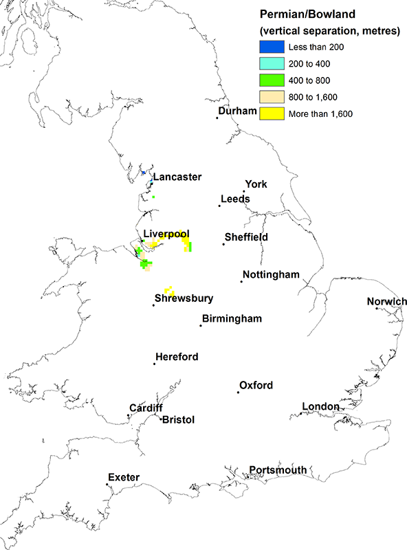
Area where both aquifer and shale are present
West Lancashire and the Cheshire Basin.
Note that for the purposes of drafting this separation map the maximum depth of the Permian Sandstone aquifer is taken to be 400 m below ground level based on the recommendations in the UK TAG report (UK TAG, 2011). More information about this can be found in the methods section.
Thickness of intervening strata
Up to 5000 m.
Lithology of intervening strata
Mixed permeability Millstone Grit and Coal Measures (mudstones, siltstones and sandstones).
Other major aquifers in the area
Triassic Sandstone (above) and Carboniferous Limestone (below)
Other shales or clays in the area
None.
Links to aquifer and shale/clay maps
View the map of the Permian Sandstone principal aquifer.
View the map of the Bowland and Craven Groups.
References
UK TAG. 2011. Defining and reporting on groundwater bodies. UK Technical Advisory Group on the Water Framework Directive, working paper V6.21/Mar/2011
Contact
Please contact BGS Enquiries for more information.


