Research methods

To help achieve the project aims, research was undertaken using three main methods:
- systematic reviews of published and grey literature
- field case studies
- detailed geological and hydrogeological analysis using GIS
These component parts of the project will be published separately in peer reviewed journals and BGS Open Reports, and will be made available from the project web pages in due course.
Data reviews
Two systematic reviews were carried out from published and unpublished literature.
The first review identified approximately 100 studies of groundwater recharge for Africa; a second review examined 250 published and grey literature on African aquifer properties.
The review process enabled unreliable studies to be excluded, but allowed for some low quality studies which passed minimum criteria to be used in areas with few data.
Case studies
Three detailed case studies were undertaken during 2010 (Figure 1).
- In West Africa approximately 60 boreholes were sampled across a transect from semi-arid to humid climate. Detailed chemical analysis was undertaken to assess the residence time of shallow groundwater used to sustain rural water supply boreholes (<0.5 l/s).
- In Uganda and Tanzania high yielding groundwater supplies from basement rocks were examined to help understand the hydrogeological conditions required to sustain higher yielding supplies (>1 l/s). Available monitoring records were collated and analysed along with pumping test data and new chemical analysis targeted to assess residence times.
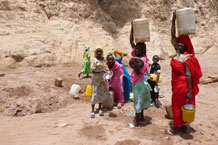
- The Ethiopian case study involved the analysis and interpretation of detailed household surveys about seasonal water access, use and livelihoods in 24 communities across three livelihood zones.
Groundwater maps

The groundwater maps were developed to provide quantitative groundwater information for Africa.
Several groundwater maps already exist for Africa, but provide only qualitative information.
Significant effort was put into collating, assessing and systematising available regional and site specific information on groundwater using GIS.
Further detail about the methodology is explained at Quantitative groundwater maps for Africa.


