Quantitative groundwater maps for Africa
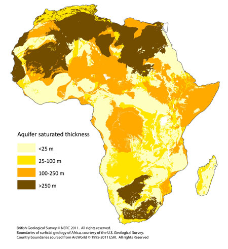
Robust quantitative groundwater maps for Africa were developed to highlight areas more likely to be resilient to climate change and also where sufficient groundwater resources may be available to help adaptation.
The maps are the first produced for Africa and are underpinned by dedicated case studies and systematic data/literature reviews.
Download the Quantitative maps of groundwater resources in Africa article published in Environmental Research Letters.
Download the Review of aquifer properties data and the Review of recharge studies reports.
Download the digital groundwater maps of Africa
Developing the maps
To understand and characterise the resilience of African groundwater to climate change requires an understanding of the spatial distribution of groundwater storage, aquifer permeability and the annual rate of recharge.
In groundwater science this means characterising:
- aquifer transmissivity (T) (the permeability of the rocks integrated over thickness)
- the effective porosity of the rocks
- the saturated thickness of the aquifers
- annual groundwater recharge
Quantitative data on transmissivity and effective porosity are scarce for much of Africa, and a series of proxies for these parameters were used instead which have been found to be an effective surrogate in data poor areas elsewhere (e.g. Graham et al., 2009):
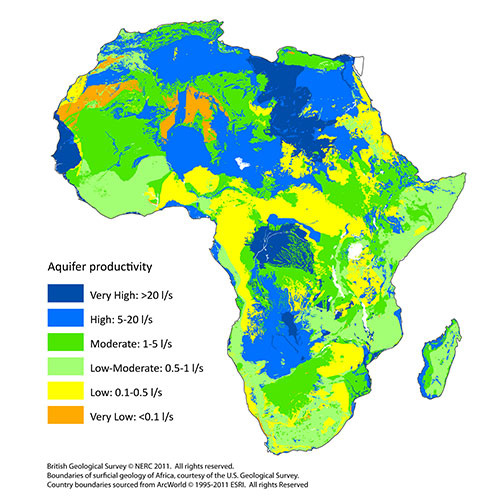
- typical borehole yields of well sited boreholes (termed aquifer productivity) — used as surrogate for T
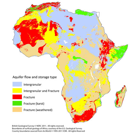
- effective porosity estimated from the flow and storage characteristics of different lithologies (termed aquifer flow/storage)
Methodology
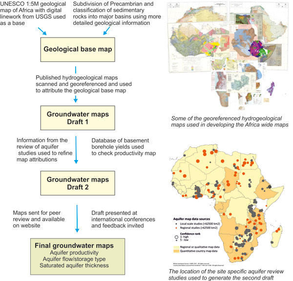
The methodology used to develop the quantitative groundwater maps (aquifer productivity, aquifer flow/storage type, and saturated aquifer thickness) is shown in Figure 2.
Every effort was made to use all available information, including:
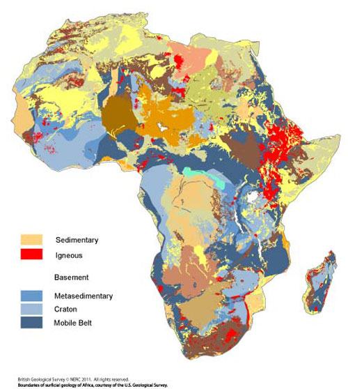
- reliable geological base maps
- all available national, regional and sub-national hydrogeological maps
- 250 papers and documents reporting groundwater studies in Africa
- and good information on borehole yields for basement rocks
The final drafts were sent for peer review to experts in African groundwater.
New quantitative groundwater maps for Africa
The maps indicate:
- wide variation in groundwater resources across the continent
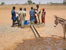
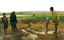
- for much of Africa, carefully sited and constructed boreholes will be able to sustain rural handpumps.
- the potential for shallow boreholes yielding greater than 5 l/s is not widespread across Africa, although smaller yields of 0.5 to 5 l/s will be easier to find. Yields of >5 l/s are required for larger town supplies or intensive irrigation
- large groundwater stores in the major sedimentary basins, which can accommodate high yielding boreholes, are often far from population centres and associated with deep water levels.
Limitations
The maps have been developed using the best available data at a continental scale for Africa; Figure 2 illustrates the extent of available data and confidence in the resulting maps.
The lack of good quality hydrogeological maps in North and West Africa is compensated for by the availability of many individual studies, which vary from local to regional scale. In Central Africa, however, both maps and study information are scarce.
Proposed use
The maps are designed to show information at the continental, or regional scale (i.e. to be used at a nominal scale of approximately 1:20 m). Their primary aim is to highlight:
- variations in groundwater resources
- their resilience to climate change
- their potential use for adaptation strategies.
They should not be used for national planning. The approach could be repeated for individual countries, but would require more detailed geological and hydrogeological information.
Contact
Contact Dr Alan MacDonald, Project Leader, for further information

