Download digital groundwater maps of Africa
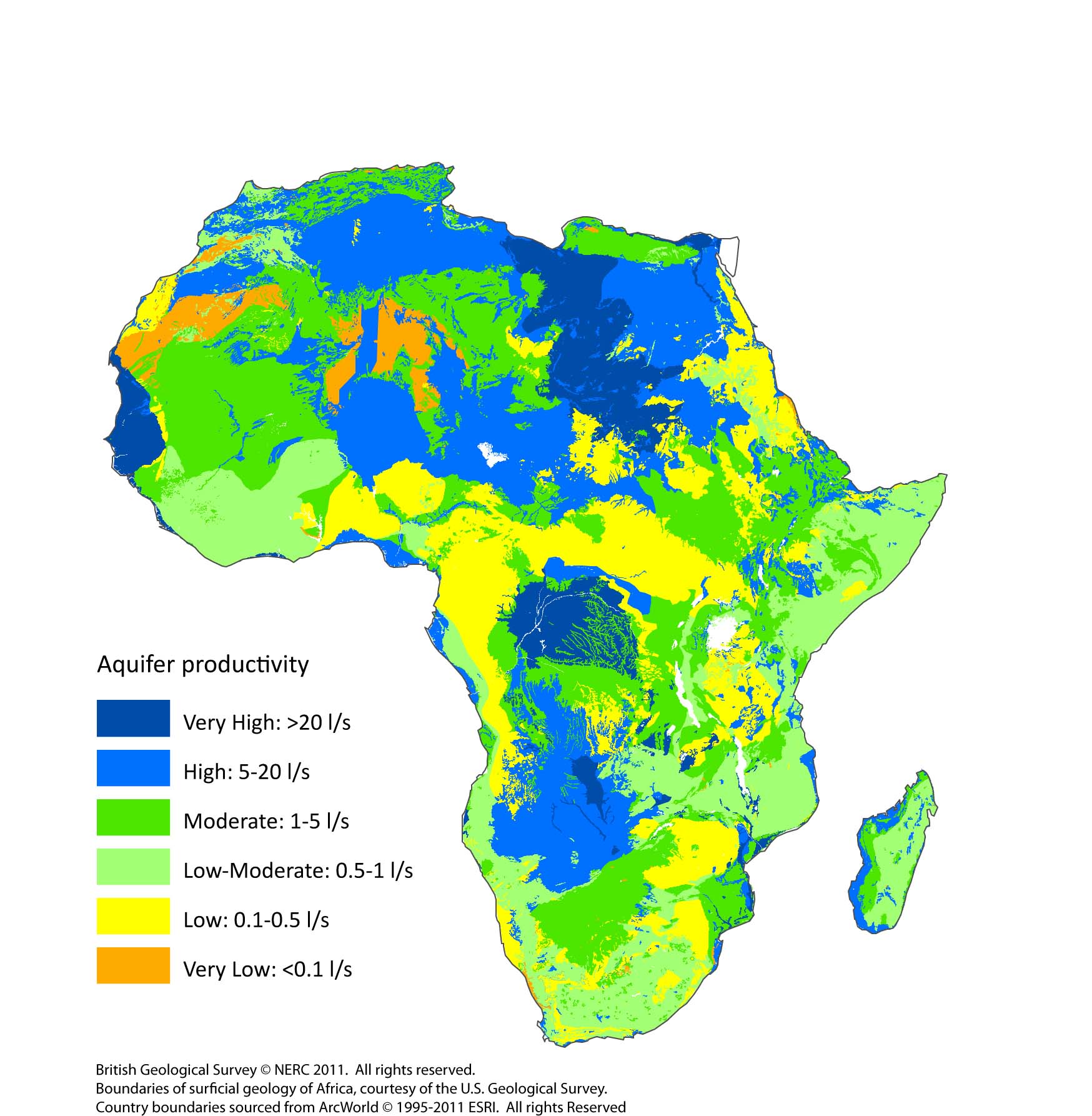
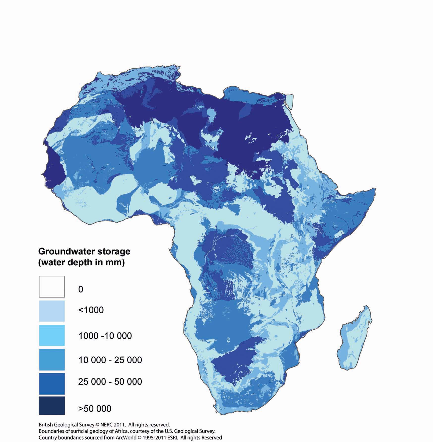
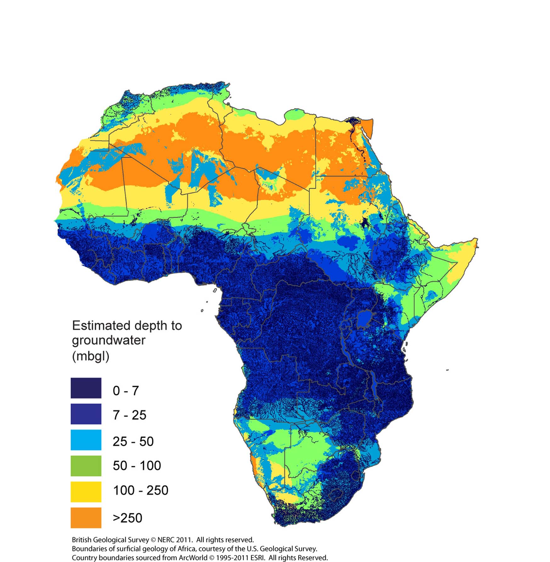
The quantitative maps of groundwater productivity, storage, and depth to groundwater can be downloaded below. Each map is available for download as a 5 km resolution grid (xyz ASCII file), and also as a high resolution PDF file.
The quantitative maps are the first produced for Africa and are underpinned by dedicated case studies and systematic data/literature reviews. They are designed to show information at the continental, or regional scale (nominally at 1:20M).
Detailed description of the methodology, and a full list of data sources, used to develop the groundwater storage and productivity maps can be found in the peer-reviewed paper (Quantitative maps of groundwater resources in Africa) on the maps and supplementary material, published in Environmental Research Letters.
View a full description of the methodology used to develop the depth of groundwater map can be found in the BGS Open Report, An initial estimate of depth to groundwater across Africa.
Please read the terms and conditions of usage of the maps.
Groundwater productivity map

The groundwater productivity map indicates what borehole yields can reasonably be expected in different hydrogeological units. The ranges indicate the approximate interquartile range of the yield of boreholes that have been sited and drilled using appropriate techniques.
- Download the groundwater productivity map as a PDF, 4.15MB
- Download the groundwater productivity map as a xyz ASCII file, 2.79MB. A readme file is included which provides key header information..
Groundwater storage map

Groundwater storage was estimated by combining the saturated aquifer thickness and effective porosity of aquifers across Africa. For each aquifer flow/storage type an effective porosity range was assigned based on a series of studies across Africa and surrogates in other parts of the world.
- Download the groundwater storage map as a PDF, 87KB
- Download the groundwater storage map as a xyz ASCII file, 2.78MB. A readme file is included which provides key header information.
Depth to groundwater map

Depth to groundwater was modelled using an empirical rules-based approach, where depth to groundwater was assigned according to rainfall and aquifer type, as well as proximity to rivers.
- Download the depth to groundwater map as a PDF, 106KB
- Download the depth to groundwater map as a xyz ASCII file, 2.73MB. A readme file is included which provides key header information.
Reference for the dataset
MacDonald, A M, Bonsor, H C, Ó Dochartaigh, B E, Taylor, R G. 2012. Quantitative maps of groundwater resources in Africa. Environmental Research Letters 7, 024009.
Contact
Contact Prof Alan MacDonald, Project Leader, for further information


