The hyporheic zone in an urban catchment

The urban environment
Many urban areas have legacy contamination from past industrial activities.
Built up areas typically have highly modified drainage and flow patterns due to the impacts of features such as:
- widespread low permeability surfaces
- storm drain systems
- modifications to the natural course of streams and rivers
- culverting of streams and canalisation of rivers, preventing water exchange with the subsurface
We are studying the hyporheic zone of urban streams and rivers in order to better understand how they could be impacting on the quality of water in those water courses.
Case study: Polmadie Burn, Glasgow, UK
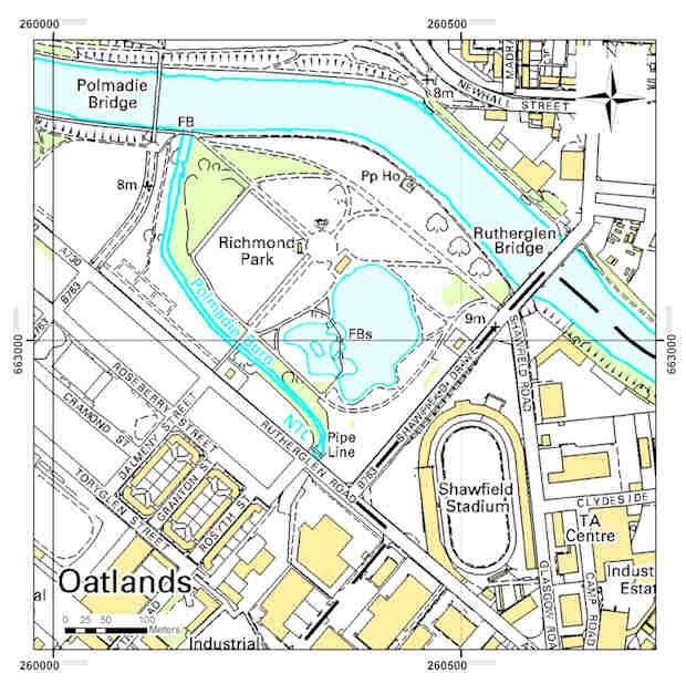
We are studying the hyporheic zone of a tributary of the River Clyde, the Polmadie Burn, in the south-east of Glasgow.
The catchment area of the Polmadie Burn includes areas impacted by the historical disposal of chromite ore processing residue (COPR).
Chromium (VI) is one of the major contaminants in the surface water. Chromium concentrations up to 6.28 mg/L have been observed in the burn water (Farmer et al., 2002).
Groundwater in this area is also highly contaminated in chromium. Although groundwater is not used for water supply in the city, it can interact with surface water through the hyporheic zone and play an important role affecting surface water ecosystems and water quality.
Research focus
Research focuses on understanding the mechanisms of chromium release, transport and attenuation in the hyporheic zone at the in-stream scale of observation.
By developing a conceptual model of the geochemical and hydrogeological controls on Cr occurrence at the study site, we aim to provide lines of evidence to complement the assessment of the linkage between urban land, groundwater and river contamination.
Our conceptual model will also help the assessment of potential risks to fresh water quality associated to groundwater-surface water interactions in an urban setting.
Approach


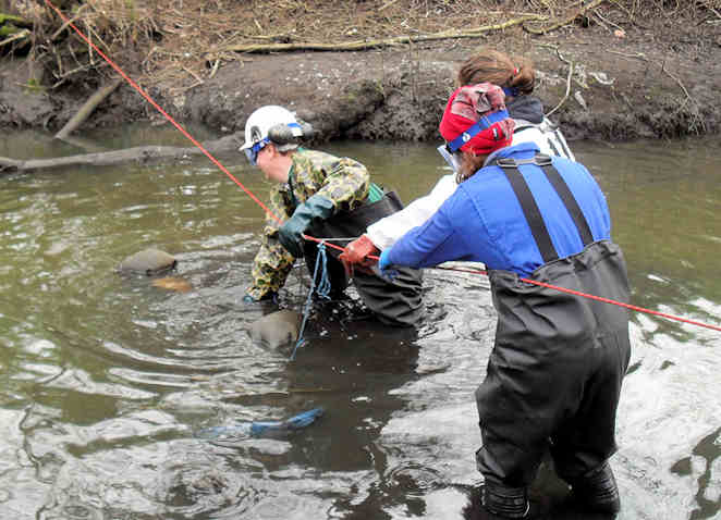
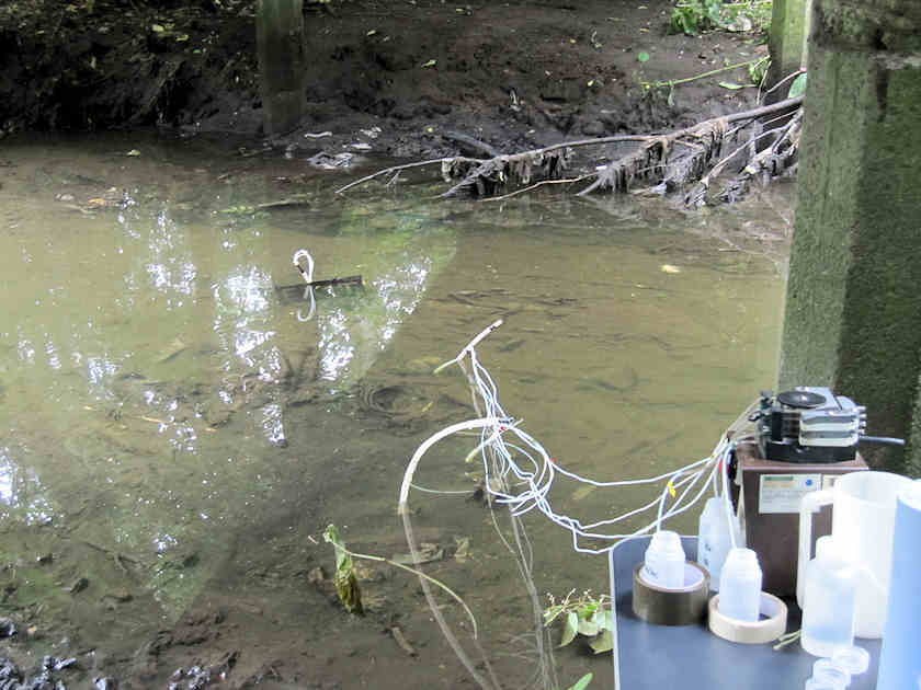
Several field trips have already been undertaken during 2011 and 2012 in order to quantify the hydraulic and chemical characteristics of the hyporheic zone of the burn, observing how these vary across the study area and over time.
The methods we employed were:
- A network of shallow multilevel piezometers were installed in the stream bed. These were used to monitor how the composition of the hyporheic water varied spatially and temporally.
- Piezometers were installed in the river banks to provide access for water quality sampling, hydraulic head measurements and rising head tests to estimate hydraulic conductivity.
- Stream flow measurements and a topographic survey contributed to contaminant mass load estimations.
- Sampling of stream water for analysis of Cr speciation.
Sediment grab samples and cores have been collected to characterise the solid phases of chromium in the sediment using mineralogical and chemical extraction methods.
Sediment resuspension and leaching tests of river bank material are planned to allow assessment of the potential sediment contribution to Cr measured in surface water.
The combination of field-based approaches will underpin the assessment of the connectivity between stream and shallow groundwater and, integrated with laboratory experiments, will allow interpreting the significance of the hyporheic zone as a contaminant source or natural attenuation zone with regards to Cr contamination at the site.
Publications
Dearden, R, and Palumbo-Roe, B. 2010. Technical notes: hyporheic zone sampling procedures. British Geological Survey, 21pp. (OR/10/048)
Reference
Farmer, J G, Thomas, R P, Graham, M C, Geelhoed, J S, Lumsdon, D G, and Paterson, E. 2002. Chromium speciation and fractionation in ground and surface waters in the vicinity of chromite ore processing residue disposal sites. Journal of Environmental Monitoring, 4(2) 235–243.
Contact
Contact Dr Barbara Palumbo-Roe for further information.
- Lead mobilisation in the hyporheic zone and river bank sediments of a contaminated stream: contribution to diffuse pollution
- Understanding groundwater, surface water and hyporheic zone biogeochemical processes in a Chalk catchment using fluorescence properties of dissolved and colloidal organic matter
- BGS catchment processes publications
- The Hyporheic Handbook, the product of a NERC-funded Knowledge Transfer Network


