Floodplains and their role in contaminant attentuation

Floodplains are active and dynamic environments. They are important zones through which groundwater moves in and out of rivers and streams.
Floodplains potentially play a key role in attenuating dissolved contaminants, particularly as they increasingly define a limit to urban expansion, forming a boundary zone between urban and rural areas.
We are investigating how the biogeochemical processes operating in floodplain environments might affect the concentrations of groundwater contaminants from urban environments reaching surface water courses.
What processes do we expect to be occurring?
Floodplain sediments are typically low oxygen environments and this will be reflected in the groundwater chemistry, e.g. low nitrate and high iron (Fe) and manganese (Mn).
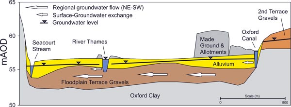
The oxygen availability and chemistry will be influenced by seasonal fluctuations in groundwater levels and periods of flooding. Where the sediments are fine-grained alluvium, groundwater movement will be slower and this will also affect the chemistry, e.g. residence time indicators such as CFCs.
Our field observatory
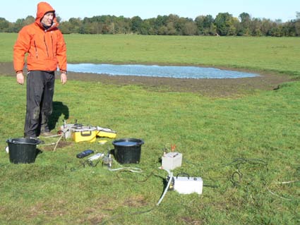
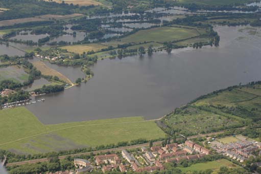
Port Meadow lies to the north-west of the city of Oxford; it is grazed by horses and cattle.
Groundwater flows across the meadow from the urban area in the east towards the River Thames in the west.
Port Meadow is prone to flooding and features an area of standing water for much of the year. Its chemistry is also impacted by the presence of an old domestic waste dump on its eastern side.

More information about the field site is provided on our Oxford field observatory page.
What sampling techniques are we using?
Samples have been collected from a number of boreholes across the study area every two months over the last year to see how chemistry varies spatially and with time as water levels change.
We also put in a new transect of nested piezometers to get a better understanding of changes in chemistry with depth and lithology.
We measure inorganic chemistry, dissolved organic carbon, phosphorus species, nitrogen species, fluorescence and use groundwater tracer/dating techniques such as CFC, SF6 and stable isotopes.
Applying all of these techniques we improve our understanding of the sources of these components (natural and anthropogenic), the geochemical processes occurring and the residence time of the groundwater in this complex, dynamic system.
What have we learned so far?
- The old domestic waste dump has a strong influence on the groundwater chemistry downgradient, e.g. high specific electrical conductance, dissolved organic carbon, sodium, chloride and alkalinity.
- Reducing conditions are prevalent across the floodplain, i.e. low dissolved oxygen, low nitrate and high Fe and Mn, although fluctuations with time and water level are seen.
- Residence time indicators suggest areas of preferential flow. There is also an additional source of CFCs.
- The River Thames appears to be stripping contaminants from the groundwater even though it appears to be poorly hydraulically connected.
How will we improve our understanding?

- Further sampling — to date we have mostly been sampling during high water level conditions.
- Application of novel techniques — nanoparticles, nitrous oxide and noble gas sampling to better understand provenance and processes.
- Use of near-surface geophysics to help characterise lithological variations and preferential flow pathways.
- Particle size-analysis and poly-aromatic hydrocarbons to study rates of sedimentation.
Contact
Contact Dan Lapworth for further information.


