Soil and near surface gas monitoring in the Vale of Pickering
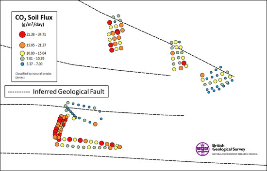
BGS monitored baseline gas in soil and the near surface at locations in the Vale of Pickering. Concentrations of carbon dioxide (CO2), methane (CH4), oxygen (O2), hydrogen sulphide (H2S) and radon (Rn) were measured in the soil, along with flux of CO2 and CH4.
The baseline monitoring was similar to that carried out in Lancashire, with the potential to utilise other gas monitoring tools. Near surface atmospheric gases (CO2 and CH4) may be measured using laser gas analysers mounted on a quad bike or similar all-terrain vehicle. This makes continuous measurements as the vehicle is driven across the fields.
Background
For many years we have been analysing soil gases and the air overlying the surface in relation to geological CO2 storage. The techniques used proved highly successful for measuring baseline gas concentrations, locating and studying rates of gas escape from natural vents, and demonstrating the absence of leakage from storage projects. The baseline data allow existing natural or man-made sources of gas to be identified and distinguished from any emission resulting from shale-gas operations.
Gas measurements
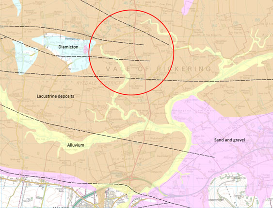
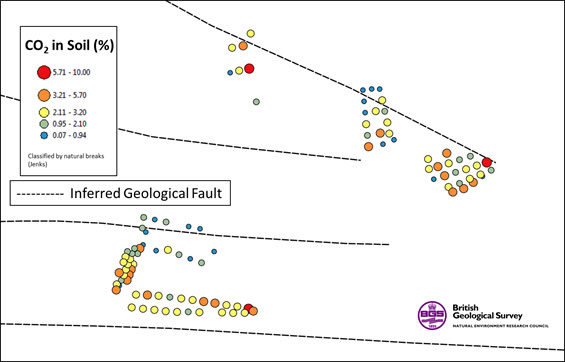
As part of our monitoring activities, we carried out sampling of near-surface gases in the Vale of Pickering in areas close to where shale-gas planning applications were submitted (KMA). This included measuring soil gas concentrations and the flux from the soil to the atmosphere.
Soil gas was monitored by hammering a small diameter steel tube into the ground to a depth of up to 1 m. Samples of the gas were then pumped to a portable field gas-analysing instrument or collected for laboratory analysis. The steel tube was then removed from the ground. Flux was determined by placing a small metal chamber onto the ground surface and measuring the flow of the gas into the chamber. Both soil gas and flux measurements only took a few minutes and caused very little disturbance to the soil or vegetation. The field methods are shown below.
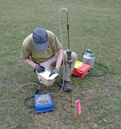
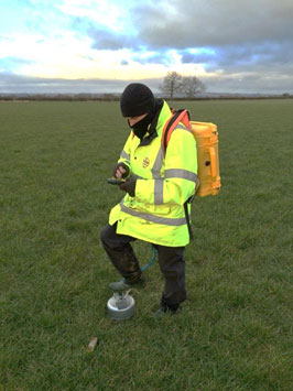
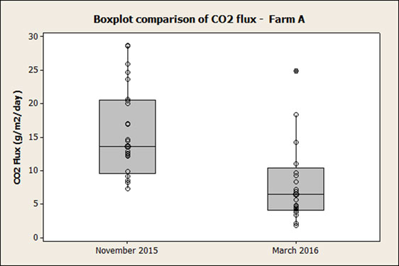
A total of 142 sample sites were measured for flux in November 2015 but soil gas could only be determined at 100 of these because of wet ground conditions. Repeat flux measurements were made at 21 sites in March 2016 but waterlogged ground prevented further work.
Contact
Contact BGS enquiries for further information.


