How to use Make-a-map
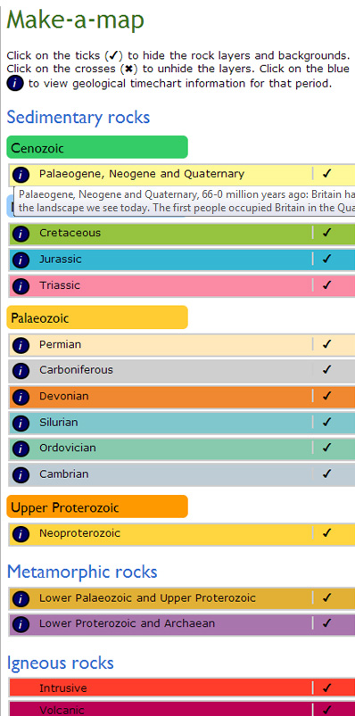
Make-a-map is a fully coloured, generalised, geological map of the British Isles, with a key to the left. The colours on the map and key match those used in the BGS Timechart.
Show or hide layers
Each of the colours on the map can be turned on or off using the corresponding ticks/crosses to the right of the key.
Click on the blue ‘information’ buttons to show the relevant geological period from the BGS Timechart.
For more details about the information shown, or to download the Timechart as pdf files, visit the BGS Timechart web page.
Hovering over the blue ‘information’ buttons shows the age range of that geological period and the environment that dominated that period.
Note: The blue ‘information’ buttons are not available for the igneous rock units as they are not subdivided by age.
Background layers
- Coastline: turns the coastline on or off (if Linework is turned off)
- Linework: turns the geological boundaries on or off (and coast if Coastline is turned off)
- Place names: turns the place names on or off
Full screen
Press the F11 function key to toggle full-screen viewing on and off; in most browsers.
Save and print
Click the ‘Save and print’ button to print your own custom Make-a-map,