
Draycott and Westbury-sub-Mendip
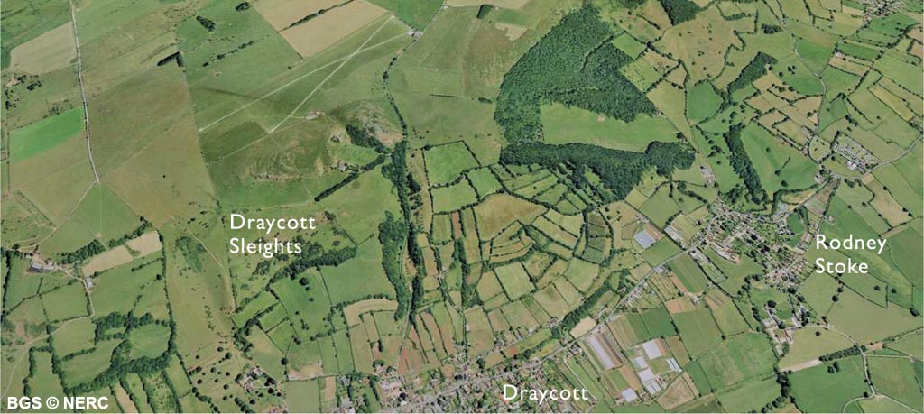
The southern flank of Mendip between Cheddar and Wells forms an imposing scarp when viewed from the south. The underlying Carboniferous Limestone here has been thrust up into a series of stacked 'sheets' of rock along two major thrust faults; the 'South-western Overthrust' and the Ebbor Thrust. The small Carboniferous Limestone inliers of Nyland Hill and Lodge Hill, rising up from the Somerset Levels to the south, represent the eroded remnants of another thrust sheet of limestone just poking through the cover of younger Triassic and Jurassic rocks.
Much of the lower slopes of the Mendip scarp are underlain by a drape of Triassic Dolomitic Conglomerate, which partially buries the Carboniferous Limestone.
Known locally as Draycott Marble, the conglomerate was quarried at several places in Draycott and Westbury-sub-Mendip, and can be seen in many of the houses and walls in the area.
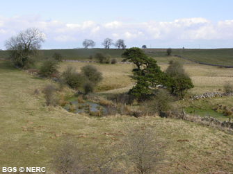
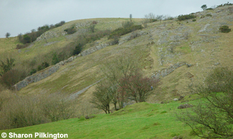
The Carboniferous Limestone outcrops in many places, but the Burrington Oolite is particularly well exposed in the Draycott Sleights nature reserve where the rocks have been folded into a small down-fold or syncline. The Upper Carboniferous Quartzitic Sandstone and the Coal Measures (mostly sandstone and shale) can be seen in the Deer Leap and Ramspit Nature Reserves. However, most of the Coal Measures is cut out by the Ebbor Thrust, which runs through the reserve. Along this fault, the Black Rock Limestone has been thrust over the top of the younger Quartzitic Sandstone. The outcrop of the sandstone is marked by a sliver of wet boggy ground, and a small stream which sinks underground in the overlying limestone along the line of the thrust fault.
Flora and fauna
The hill above Draycott is known as Draycott Sleights. Now a nature reserve, Draycott Sleights contains a variety of habitats including several types of herb-rich limestone grassland with scattered scrub, rocky limestone crags, small cliffs and rock exposures. The Rodney Stoke National Nature Reserve encompasses broad-leaved woodland, scrub and limestone grassland and is a good example of a typical Mendip ash wood.
Caves
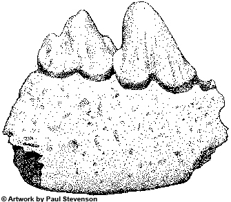
In 1969, blasting in Westbury Quarry exposed a massive sediment-filled cave, at least 70 m long and 30 m high. Excavations by the Natural History Museum in the 1970s discovered abundant small mammal bones and in places the remains of the extinct cave bear Ursus deningeri. The deposits were laid down in a Middle Pleistocene interglacial period about 620 000 years ago.

Closed basins
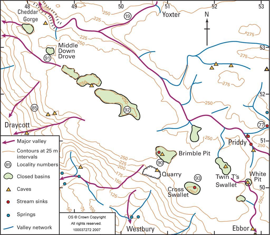
A belt of twelve large closed basins punctuate the southern rim of the Mendip plateau between Cheddar and Ebbor Gorge. These hollows are formed by the dissolution of the limestone. During the last glaciation underground drainage was impeded by permafrost and these depressions became lakes. Their floors are covered with glacial windblown loess, and often pockmarked by sinkholes where the loess has subsided into cavities in the underlying limestone.
Once of the best developed basins is at Brimble Pit, near Westbury-sub-Mendip where the former lake bed contains a small pond and nine sinkholes. Another occurs in the Somerset Wildlife Trust's Middledown Reserve, and is marked by two large sinkholes. Two other closed basins can be seen; the road from Draycott to Cheddar Head crosses one at Bristol Plain Farm, and the other, Cross Swallet, can be seen from the Priddy–Westbury footpath.
- Home
- Overview maps
- Locality
areas
- Cheddar Gorge
- Charterhouse
- Blackdown
- Burrington Combe
- Shipham & Rowberrow
- Crook Peak & Axbridge
- Banwell to Churchill
- Priddy
- Harptree & Smitham Hill
- Draycott & Westbury-sub-Mendip
- Wookey Hole & Ebbor Gorge
- Wells
- Great Elm & Vallis Vale
- Mells & the Wadbury Valley
- The Vobster area
- The Whatley area
- Torr Works & Asham Wood
- Beacon Hill
- Stoke St Michael & Oakhill
- Holwell & Nunney
- Shepton Mallet & Maesbury
- Gurney Slade & Emborough
- The Nettlebridge valley
- Geology
- Minerals and mines
- Quarrying
- Caves and karst
- Biodiversity
- Detailed site information
- Acknowledgements
- External links
- Search
- Site map