1:250,000 maps
Geological maps at this scale are a summary of larger scale survey maps and as such are intended to provide a regional overview. The maps are published as:
- Bedrock (Solid)
- Quaternary (Superficial)
Bedrock
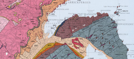
Extract from the 1997 1:250,000 Bedrock Map.
The geology of Northern Ireland and of the surrounding counties in the Republic of Ireland are depicted on this map which forms the basis for The Geology of Northern Ireland: Our Natural Foundataion.
Quaternary
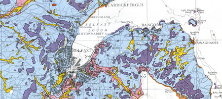
Extract from the 1991 1:250,000 Quaternary Map.
The geology of Northern Ireland depicted on this map were derived from available resurvey and provisional linework from first survey maps.
The digital 1:250,000 Bedrock and Quaternary maps are available on the GeoIndex.
For more information on licensing digital data visit contact the GSNI Information Delivery Team.